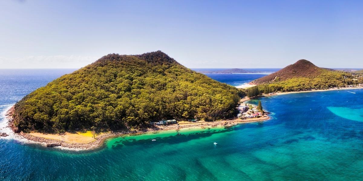
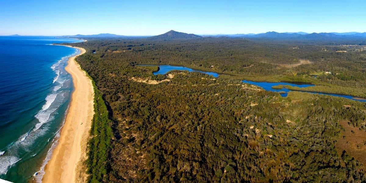
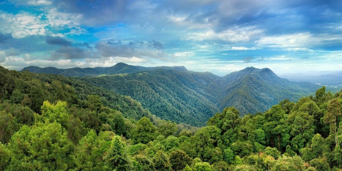
The Bellingen Shire is renowned for its incredible natural environment and the diversity of landscapes. From the heritage Gondwana rainforest of the escarpment of the Great Dividing Range, lush valleys of sub-tropical vegetation and dairy farming paddocks surrounding Bellingen, to the long white stretches of sand and surf along the coastline near Urunga, the scenery continues to capture hearts and has people wanting to return over and over for more.
53% of the Bellingen Shire LGA comprises National Park and State Forest, so it is of no surprise that there are some great walking trails in and around the Shire. Below, we have included a mix of our favourite walks to suit a range of abilities. There are many accessible boardwalks and walking paths, along with more challenging bushwalks.
Nature Walks Around Urunga
Urunga is the place where the rivers meet the sea, and is where the Bellinger and Kalang Rivers converge before heading out to the ocean. The mangroves, coastal scrubland, and woodland, provide habitat in the estuaries, wetlands, and coastal forests for a rich and diverse range of species, and there are a range of walks that take you through many of these environements.
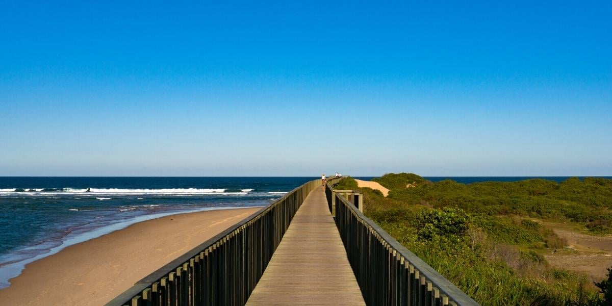
Urunga Boardwalk - Accessible
The Urunga boardwalk is probably the most popular nature walk in the shire. The boardwalk extends from the tidal swimming pool with its jetty and pontoons for one kilometre over the lagoon that runs adjacent to the coast all the way to the 4WD beach access track before Hungry Head to the south of town, over mangroves and then along the breakwall until it reaches the ocean.
This walk is not only remarkable for the variation in coastal vegetation, but mainly for how species-rich the estuary is with its fish pools, the thousands of soldier crabs you will pass in low tide, pelicans, rays, large turtles, Eastern water dragons, kangaroos and wallabies, and on a lucky day, dolphins and passing whales,
the ~2km return trip should take you roughly half an hour, and there are seats along the way and two viewing platforms. Those accessing in a wheelchair may want to go with a friend as some sections are narrow without wheel guard rails so can be tricky when people are passing.
Location: The boardwalk can be found by turning into the Reflections Holiday Park on Morgo Street, Urunga. There is car parking, bathroom facilities, a saltwater lagoon swimming pool, and children's playground.
Urunga to Wenonah Headland Beach Walk
If you are looking to walk barefoot on the sand as the waves gently lap your feet, then the walk from Urunga to the Native Title Lands of Wenonah Headland along the state forest flanked beach will be on your to-do list.
Beginning at the end of the 1km boardwalk, the walk down the coast and back is approximately a 10km return trip to Wenonah Headland, a popular hidden gem loved by locals and those in the know. Make sure you pack some water and a picnic lunch to have at the headland before turning back. However, it is important to be mindful when you are visiting, as Wenonah is a sacred place to the Gumbaynggirr People and it is important to only leave footprints behind.
If the weather is warm enough (which it is for most of the year here) make sure you pack a towel and your swimmers so you can have a refreshing ocean dip along the way at Hungry Head which is patrolled during school holidays and on weekends in the warmer months.
If the 10km beach walk is a little too much, you can park your car at Hungry Head lookout and head in either direction. The walk to Wenonah is just a little longer than if you head north towards town.
Location: Parking is available at the Urunga Boardwalk carpark or at Hungry Head near the Surf Life Saving Club where you will also find bathroom facilities.
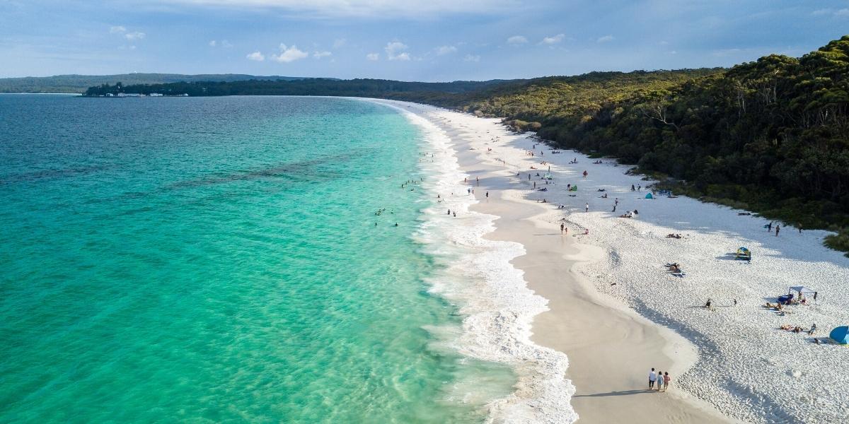
If you enjoy your beach walks, then make sure you head up to Mylestom's 8.75km North Beach, the longest beach in the region extending to Bongil Bongil in the north and the Bellinger River and Urunga in the South, but be-warned that it is ill advised to swim south of the Surf Life Saving Club because of the strong currents.
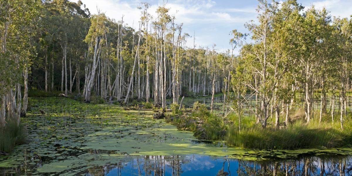
Urunga Wetlands Boardwalk - Accessible
This short, accessible walk is a favourite for both locals and visitors and contains a history of regeneration after the soils and wetlands were polluted by the old antinomy processing plant that was previously located at the site.
Heavy metals waste left behind by the operators after the closing of the plant in 1974 resulting in antimony, arsenic, lead, and reagent residues of cyanide and cresylic acid contaminating the surrounding wetlands area and causing large scale die back of the swamp paperbark, as well as affecting the native wildlife reliant on the wetlands environment for their survival.
A detailed remediation process began in 2011 after the land was reclaimed and turned into Crown Lands, and the wetlands were opened to the public in 2017, although swimming and boating in the waters is still prohibited.
The 150 metre boardwalk allows visitors to walk directly over the wetland, with an additional 450 metre gravel walking track that loops back to the starting point. There is a seated area halfway across the water which makes for a perfect spot for reflection as you listen to the sounds of the frogs, ducks and many other species that call the wetlands their home.
Location: Hillside Drive, Urunga near the corner of Giinagay Way. There is small carpark onsite.
Urunga to Hungry Head Shared Footpath - Accessible
If you are looking for a longer accessible walk or have brought your bikes, the ~3km shared cycleway to Hungry Head from the Urunga boardwalk will take you alongside the lagoon until you reach the headland. The one-way walk takes approximately 35 minutes, or 10 minutes by bike, passing the Waaraaday Wood Duck sculpture dedicated to Uncle Tom Kelly, and when you get closer to your destination at Hungry Head, there is a good chance that you will spot a wallaby or kangaroo if you head out in the early morning or late afternoon, among many other incredible wildlife that call the area their home such as sea eagles, kookaburras and possibly even a goanna.
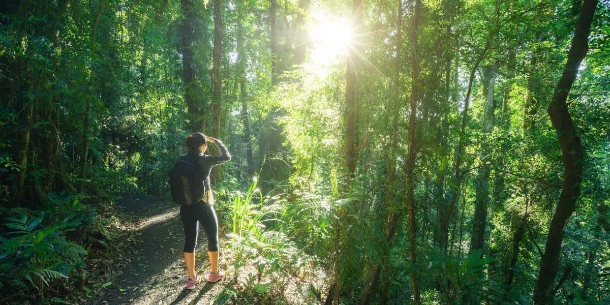
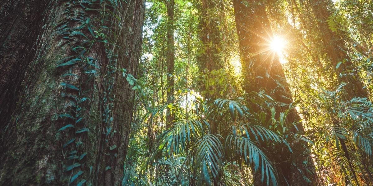
Dorrigo National Park rainforest Walking Trails
One of the most magical places in the country, the Dorrigo National Park is a place of untouched beauty. Only 45-minutes along Waterfall Way from Urunga, the World Heritage-listed Gondwana Rainforest is the perfect spot for a picnic lunch, magnificent bird watching, and waterfall walks that heal the soul.
Crystal Shower Falls Walk
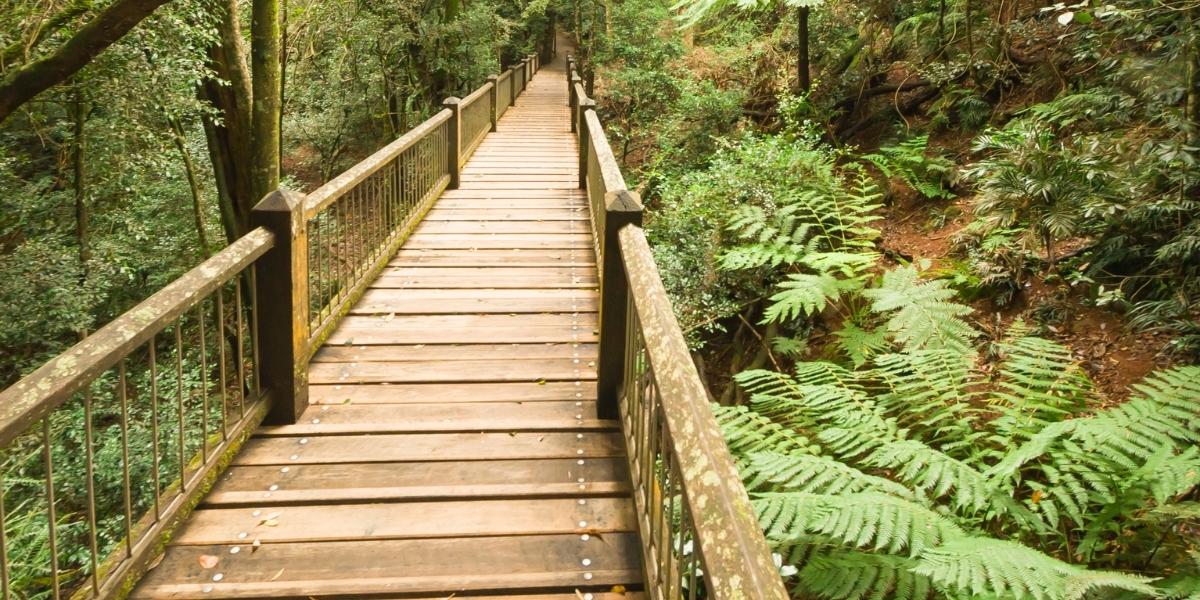
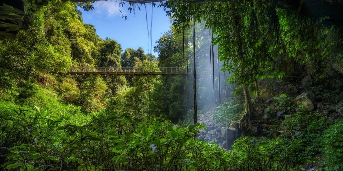
The most iconic walk within the Dorrigo National Park, this moderate 4.4km return walk from the Rainforest Centre to Crystal Shower Falls and back, will take around 1.5-2hrs to complete. The compacted track through the Gondwana rainforest slopes towards a valley with a suspension bridge that looks directly over the falls and makes for the best photo op, plus fun for the kids, and there is also a short track that leads to a cavern underneath the waterfall allowing you to look through the veil of cascading water.
Although this walk does not require any bushwalking experience, please note it is sloped, and there are the occasional steps.
The Crystal Showers Walk can be shortened by parking at The Glade picnic area and taking Satinbird Stroll, or extended for a longer walk by taking the 6.6km Wonga Walk Circuit loop track which will pass both Crystal and Tristania Falls.
Best to visit the Rainforest Centre and seeking advice as to the best track for you if you are unsure.
Walk with the Birds boardwalk - Accessible
This quick 500m easy grade walk takes you through the rainforest canopy across an elevated boardwalk, giving you the best opportunity for birdwatching in the park. There are around 150 various species of birds located within the National Park, and you have a good chance of spotting lyrebirds, brush turkeys, riflebirds and many more.
Start at The Glade picnic area, then take the northern arm of Satinbird stroll for 200m to you reach the boardwalk section of the looped walk.

Red Cedar Falls Walking Track
More experienced bushwalkers will want to head over to the Never Never picnic area and try one of the harder grade, and more private walks such as the 8km 3hr Red Cedar Falls Walking Track.
Red Cedar Falls is the largest waterfall in the Dorrigo National Park, and the strenuous zig-zagged walk to get there is certainly worth the reward. The walk begins from the picnic area by following the Rosewood Creek Walking Track for 2km before a 1.2km steep descent to the base of the falls. The size of the 600 year old trees in this section of the National park is nothing short of impressive. On the way back there is the option to swing right and complete the Rosewood Creek track or return the way you came.
The Never Never picnic area is around a 15 minute drive from the Rainforest Centre. The Casuarina Falls Circuit and Blackbutt Walking Track are other walking tracks that leave from the Never Never picnic area for keen bushwalkers to take, however, we highly recommend that anyone taking any of these walks fills out the Trip Intention form online before heading out and grab a Personal Locator Beacon (PLB) from the Rainforest Centre as there is minimal mobile coverage in the National Park.
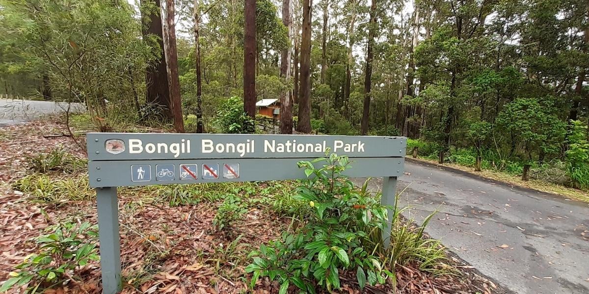
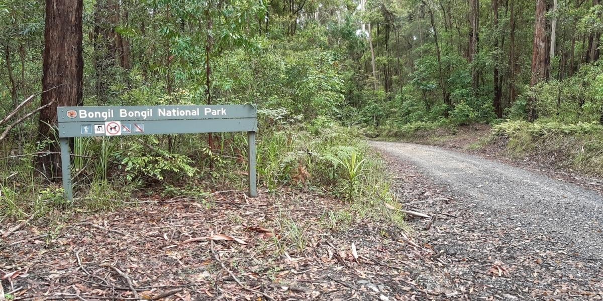
Bongil Bongil National Park
If you have come to the region to spot a koala, then according to the region's foremost koala tracker, this is hands down the best place to head to have a crack. The Bongil Bongil eucalypt forests are home to one of NSW’s largest koala populations, but if you don't have any luck with the koala spotting, it also makes a great destination for avid bird watchers with over 165 species including the glossy black cockatoo and little lorikeet.
Bongil Bongil is only ten minutes north of Urunga and a fantastic alternative to the Dorrigo National Park if you want to avoid the longer mountain drive and steep tracks.
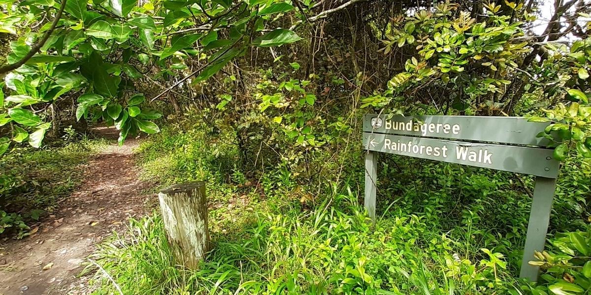
Bundageree Rainforest walk
The favourite Bongil Bongil trail is the Bundageree Rainforest walk, a moderately easy looped track that hugs the coast and is only a few minutes from the town of Repton at the end of Tuckers Rock Road (but a warning, the road is gravel after you enter the park).
Beginning from North Beach, the 6km track takes you through coastal rainforest and then along the shoreline and provides a great opportunity to watch Lewin’s honeyeaters and satin bowerbirds, and sea eagles on the return.
There is also an option for those not wanting to return in the full sun along the coast after reaching Bundageree Creek, to head back the way you came in the rainforest's shade.
Make sure you pack a picnic lunch to enjoy at the forested seaside Bluff Loop Picnic Area.
For those wanting to extend their walk, there is the option to link up to Bluff Loop Walking track, plus there are plenty more tracks that you will pass on the way there.
Muurlay Baamgala cycle trails
This shared track is a fantastic way to explore the Bongil Bongil National Park forest with the whole family, whether you are travelling by mountain bike or on foot. There are over 80km of reasonably flat fire trails to navigate, and most of the time you will have the forest all to yourself and the many species that make this place their home.
We recommend parking at the Sid Burke picnic area off Pine Creek Way as the trails from here are the best place to spot a koala so make sure you take the time to check for claw markings on the trees, and bring your binoculars if you have some. At the picnic area, there are toilet facilities and a large bike map to help plan your adventure.
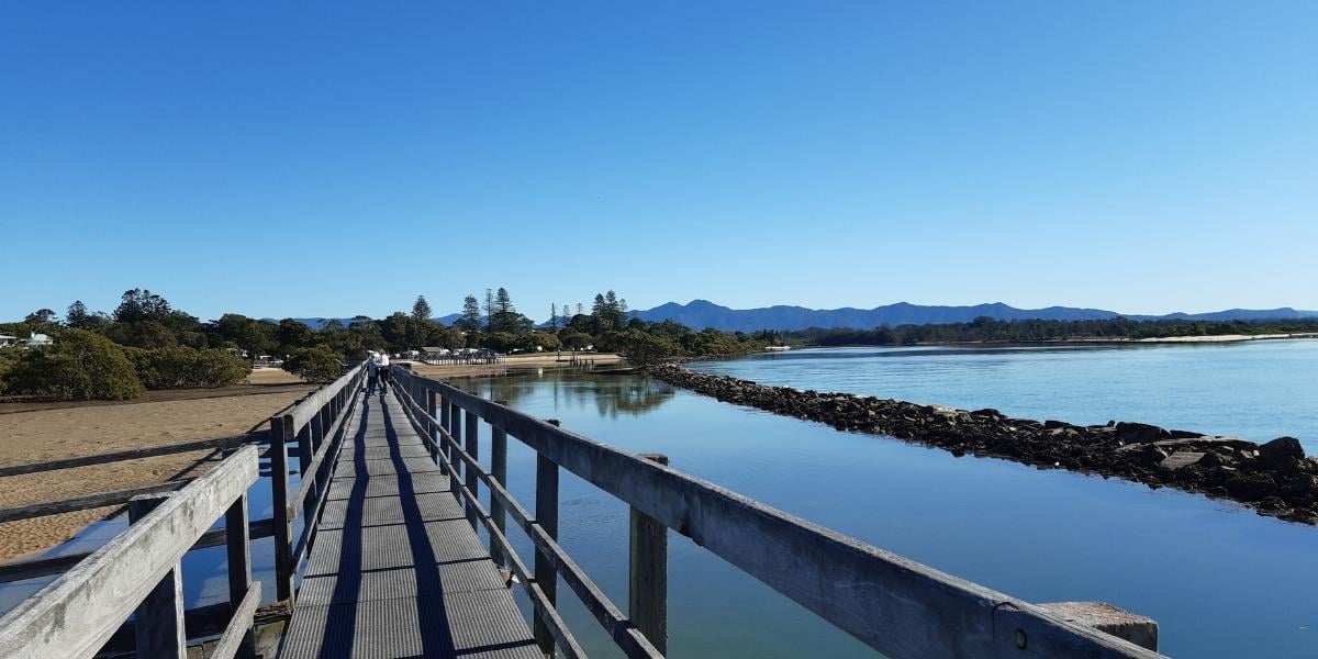
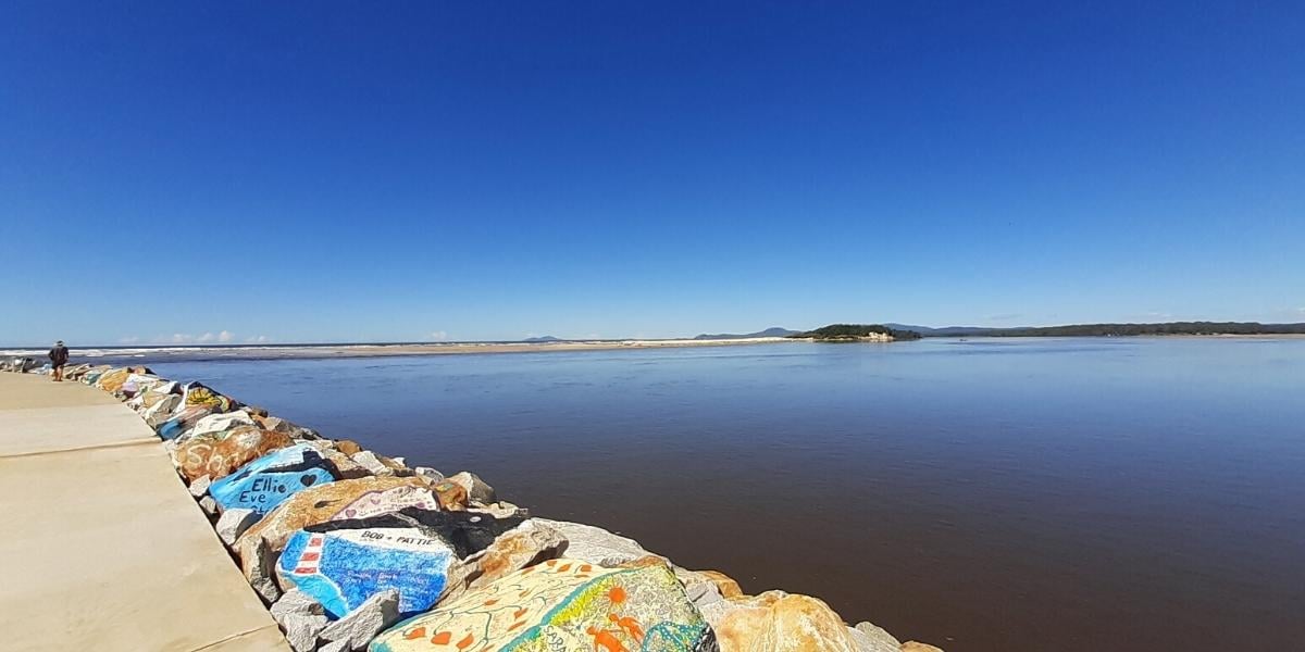
Nambucca V-Wall & Boardwalk - Accessible
The accessible shared V-Wall and Boardwalk pathway hugs the Nambucca River to where it meets the ocean from the old Tourist Information Centre for ~3km to the end of the colourful V-Wall gallery of painted rocks from visitors and locals, past and present ,
The walk comprises both sealed path with some sections of boardwalk that take you over mangroves as you near the river mouth, and taking you past the children's playgrounds at Gordon and Bellwood Parks so the kids can have a play, and the Wharf Street and Boatshed cafes and the V-Wall Tavern if you decide to break up your walk with a coffee stop or lunch.
This is definitely one of our favourite local nature walks due to its accessibility and the variety of picturesque scenery. Make sure you keep your eyes peeled for passing dolphins in the river.
Visit Coffs Trails for lots more amazing nature walks in the area.
Find more things to do when visiting Urunga and the Bellingen Shire.